Property Record
Wyatts Mill Rd, Jarratt, VA 23867
NEARBY LISTINGS FOR SALE OR LEASE
-
-
View all Jarratt listings for lease on LoopNet.com
Property Detail
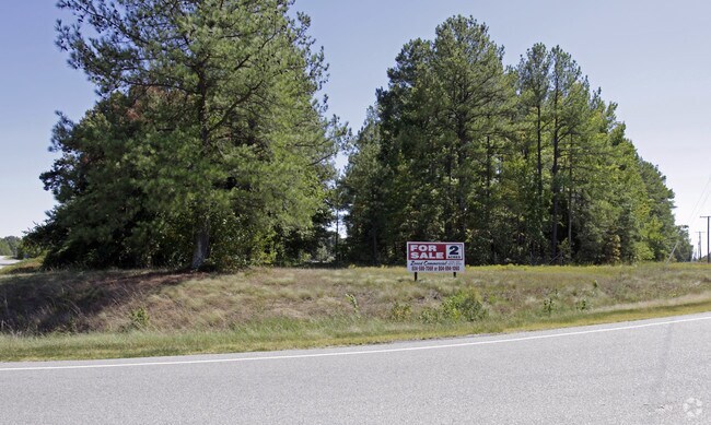
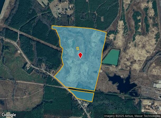
Wyatts Mill Rd
12-12
N SIDE ST HWY 608 & N & S SIDE N & W RR INST 170000622; 070000230 141.42 ACRES
Vacantlandnec
Greensville
X
Virginia
51081C0103D
141.42 AC
2024
Virginia Regional
2024
Other Market Areas
880101
DEMOGRAPHICS near Wyatts Mill Rd
1 mile
3 mile
5 mile
2024 Total Population
243
1,450
2,239
2029 Population
237
1,423
2,196
Pop Growth 2024-2029
(2.47%)
(1.86%)
(1.92%)
Average Age
43
44
44
2024 Total Households
96
590
925
HH Growth 2024-2029
(2.08%)
(1.86%)
(1.84%)
Median Household Inc
$77,885
$57,762
$61,753
Avg Household Size
2.30
2.30
2.20
2024 Avg HH Vehicles
3.00
2.00
2.00
Median Home Value
$161,666
$144,117
$143,067
Median Year Built
1986
1980
1980
Nearby Places
Map Layers
Map Styles
 Street
 Aerial
Transit
 Traffic
 Biking
Places
Listings with unknown addresses are not visible on the map
- Restaurants
- Banks
- Shops
- Fitness
- Groceries
SALE & LEASE HISTORY
LISTING DATE
SALE/LEASE

Sep 25, 2016
For Lease
Sep 24, 2016
For Sale
Nearby Properties
Address
Land Use
TOTAL SIZE
Lot Size
Zoning
Address
Land Use
TOTAL SIZE
Lot Size
Zoning
425.34 AC
A-1
Address
Land Use
TOTAL SIZE
Lot Size
Zoning
17,630 SF
1,105.29 AC
A-1
Address
Land Use
TOTAL SIZE
Lot Size
Zoning
166,543 SF
136.10 AC
M-1
Address
Land Use
TOTAL SIZE
Lot Size
Zoning
414.54 AC
A-1
Address
Land Use
TOTAL SIZE
Lot Size
Zoning
5.72 AC
Address
Land Use
TOTAL SIZE
Lot Size
Zoning
1.48 AC
M-1
Address
Land Use
TOTAL SIZE
Lot Size
Zoning
130.61 AC
M-1
Address
Land Use
TOTAL SIZE
Lot Size
Zoning
2.22 AC
Address
Land Use
TOTAL SIZE
Lot Size
Zoning
2,547 SF
7.10 AC
Address
Land Use
TOTAL SIZE
Lot Size
Zoning
1.18 AC
Address
Land Use
TOTAL SIZE
Lot Size
Zoning
473.96 AC
Address
Land Use
TOTAL SIZE
Lot Size
Zoning
597.67 AC
M-1
Address
Land Use
TOTAL SIZE
Lot Size
Zoning
746.20 AC
A-1
Address
Land Use
TOTAL SIZE
Lot Size
Zoning
0.85 AC
Address
Land Use
TOTAL SIZE
Lot Size
Zoning
0.86 AC
Address
Land Use
TOTAL SIZE
Lot Size
Zoning
6,016 SF
0.55 AC
Address
Land Use
TOTAL SIZE
Lot Size
Zoning
353.96 AC
SPLT
Address
Land Use
TOTAL SIZE
Lot Size
Zoning
7.05 AC
M-1
Address
Land Use
TOTAL SIZE
Lot Size
Zoning
0.29 AC
A-1
Address
Land Use
TOTAL SIZE
Lot Size
Zoning
3,486 SF
196.16 AC
A-1
Address
Land Use
TOTAL SIZE
Lot Size
Zoning
7,500 SF
1.72 AC
Address
Land Use
TOTAL SIZE
Lot Size
Zoning
465.12 AC
A-1
Address
Land Use
TOTAL SIZE
Lot Size
Zoning
2.89 AC
Address
Land Use
TOTAL SIZE
Lot Size
Zoning
2.55 AC
Address
Land Use
TOTAL SIZE
Lot Size
Zoning
343.59 AC
A-1
Address
Land Use
TOTAL SIZE
Lot Size
Zoning
1,512 SF
225 AC
A-1
Address
Land Use
TOTAL SIZE
Lot Size
Zoning
0.22 AC
Address
Land Use
TOTAL SIZE
Lot Size
Zoning
3,048 SF
1.53 AC
Address
Land Use
TOTAL SIZE
Lot Size
Zoning
474 AC
A-1
The World's #1 Commercial Real Estate Marketplace
Connect with us
© 2026 CoStar Group
The information above has been obtained from sources believed reliable. While we do not doubt its accuracy we have not verified it and make no guarantee, warranty or representation about it. It is your responsibility to independently confirm its accuracy and completeness. Any projections, opinions, assumptions, or estimates used are for example only and do not represent the current or future performance of the property. The value of this transaction to you depends on tax and other factors which should be evaluated by your tax, financial, and legal advisors. You and your advisors should conduct a careful, independent investigation of the property to determine to your satisfaction the suitability of the property for your needs.